Cheynes Beach Caravan Park located on the quiet fringes of Waychinicup National Park, the Cheynes Beach Caravan Park is situated on the protected cove of Cheynes Beach, east of Albany. The crystal clear waters and sparkling white sand provide ideal fishing, whale watching, and water sporting activities.
Cheynes Beach is a home to rare endangered birds, wildflowers native fauna, the area is surrounded by Waychinnicup National Park which contains a beautiful inlet unique rock formations.is a protected cove, situated 68kms east of Albany, an accessible beach that stretches fkilometres with aqua blue waters sparkling white sands. A pristine untouched area, Cheynes Beach offers a diversity of activities from excellent fishing, boating, water sports, whale watching bush walking. Home to rare endangered birds, wildflowers native fauna, the area is surrounded by Waychinnicup National Park which contains a beautiful inlet unique rock formations.
Readmore..
Sunday, January 20, 2013
Wednesday, January 2, 2013
Byron Bay
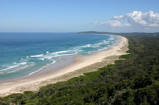 |
| Byron Bay |
 |
| Surfing at Byron Bay |
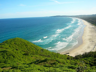 |
| Byron Bay View |
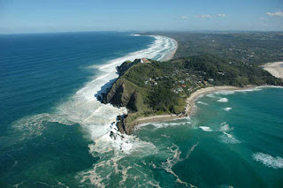 |
| Byron Bay |
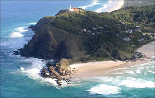 |
| Byron Bay |
Wednesday, December 19, 2012
Table Mountain
 |
| Table Mountain |
 |
| Night View of Table Mountain |
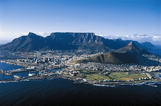
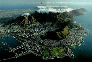
The main feature of Table Mountain is the level plateau approximately 3 kilometres from side to side, edged by impressive cliffs. The plateau, flanked by Devil's Peak to the east and by Lion's Head to the west, forms a dramatic backdrop to Cape Town. This broad sweep of mountainous heights, together with Signal Hill, forms the natural amphitheatre of the City Bowl and Table Bay harbour. The highest point on Table Mountain is towards the eastern end of the plateau and is marked by Maclear's Beacon, a stone cairn built in 1865 by Sir Thomas Maclear for trigonometrical survey. It is 1,086 metres (3,563 ft) above sea level, about 19 metres (62 ft) higher than the cable station at the western end of the plateau.
 | |
| Table Mountain port |
 |
| Table Mountain - tablecloth |
The Table Mountain project was delayed yet again by war; this time the outbreak of the First World War (1914-1918). The plan was resuscitated in 1926 after a Norwegian engineer, Trygve Stromsoe, presented plans for a cableway to the top of Table Mountain. The plan caught the collective eye of a group of eminent local businessmen. The idea that an easy route up would finally become a reality drew them together, forming the Table Mountain Aerial Cableway Company (TMACC) to finance the construction. Work began soon afterwards and the project was finished relatively quickly. On the 4th of October 1929, the Mayor of Cape Town, Rev A J S Lewis, headed the official opening ceremony that was attended by over 200 other guests.
 |
| Table Mountain |
Outdoor Equipment
Since it's opening in 1929, over 16 million people have taken the trip to the top of Table Mountain. The Table Mountain cableway has since become something of a landmark in Cape Town, and has carried some of Cape Town's most illustrious visitors including King George VI and Queen Elizabeth II, as well as Oprah Winfrey, Sting, Stefi Graf, Arnold Schwarzenneger, Magaret Thatcher, Prince Andrew, Micheal Schumacher, Brooke Shields, Micheal Buble, Tina Turner, Jackie Chan, Dolores O'Riordan, Skunk Anansie and Paul Oakenfold. In 1993, Dennis Hennessy, the son of one of the founders of TMACC sold the company. The new directors immediately set about planning an upgrade to the existing Table Mountain infrastructure. Readmore..
Bondi Beach
Outdoor Products:
 |
| Bondi Beach |
 |
| Bondi Beach |
In 1809, the road builder William Roberts received a grant of land in the area. In 1851, Edward Smith Hall and Francis O'Brien purchased 200 acres (0.81 km2) of the Bondi area that included most of the beach frontage, which was named the "The Bondi Estate." Hall was O'Brien's father-in-law. Between 1855 and 1877 O'Brien purchased his father-in-law's share of the land, renamed the land the "O'Brien Estate," and made the beach and the surrounding land available to the public as a picnic ground and amusement resort. As the beach became increasingly popular, O'Brien threatened to stop public beach access. However, the Municipal Council believed that the Government needed to intervene to make the beach a public reserve. On 9 June 1882, the Bondi Beach became a public beach.
 |
| Bondi Beach |
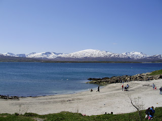
The beach is backed by attractive parkland, where you can relax, play games or take a walk. It is also a popular place amongst rollerbladers, skaters and cyclists. There is a fantastic promenade backing the beach, which continues along the coast, around the headland. Heading towards the northern headland you can also see one of Sydney's Aboriginal sites. Within the golf course there are some great Aboriginal rock engravings, giving you an excuse to have a break from the game.
 |
| Bondi Beach |
On 6 February 1938, 5 people drowned and over 250 people were rescued after a series of large waves struck the beach and pulled people back into the sea, a day that became known as "Black Sunday".
Bondi Beach was a working class suburb throughout most of the twentieth century. Following World War II, Bondi Beach and the Eastern Suburbs became home for Jewish migrants from Poland, Russia, Hungary, Czechoslovakia and Germany, while a steady stream of Jewish immigration continues into the 21st century mainly from South Africa, Russia and Israel, and the area has a number of synagogues, a kosher butcher and the Hakoah Club.
 |
| Surfing at Bondi Beach |
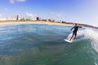
There is an underwater shark net shared, during the summer months, with other beaches along the southern part of the coast. Pods of whales and dolphins have been sighted in the bay during the months of migration. Fairy penguins, while uncommon, are sometimes also seen swimming close to shore or amongst surfers in southern line-up. Readmore..
Tuesday, December 18, 2012
De Hoop Nature Reserve
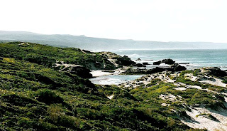 |
| De Hoop Nature Reserve |
Readmore..
Monday, December 17, 2012
Bontebok National Park
 |
| Bontebok |
Bontebok National Park is home to more than 300 bontebok, and various other animals such as duiker, zebra and steenbok. Bontebok National Park is situated along the Breede River about 6 km south of Swellendam and 220 km from Cape Town. It is also the rarest antelope species in the world. Recently upgraded day visitor facilities include a rest camp and a new road connecting the original park to 700 ha of new land donated in 2000 by the local municipality. Situated in the southern Cape, with the Breede river flowing through it, the varieties of fauna and flora and fynbos are spectacular.
Readmore..
Friday, September 30, 2011
Rebo Beach
Rebo beach is a virgin beach with the very beautiful coral reefs view. Rebo beach is 8 km from Sungailiat, Bangka Belitung Province. The beach is located in the Village Rebo Rebo, Boxwood Village, Sungailiat District, Bangka regency. With the beautiful foothill, make this beach visited by many tourists all over, especially in the holiday season. The beach is unspoiled, sandy beaches and fine white concave.
Readmore..
Subscribe to:
Posts (Atom)


